The Captain John Smith Chesapeake National Historic Trail follows the route undertaken by members of the Jamestown colony throughout the Chesapeake Bay in 1608. In part two of this three-part series, the author covers the different sections of the trail to explore.
Captain John Smith’s two longest voyages of exploration took place in the summer of 1608. Over the space of three months, he and his crews traveled to the Upper Bay twice, with a turnaround of only three days in between. What follows are summaries of those explorations.
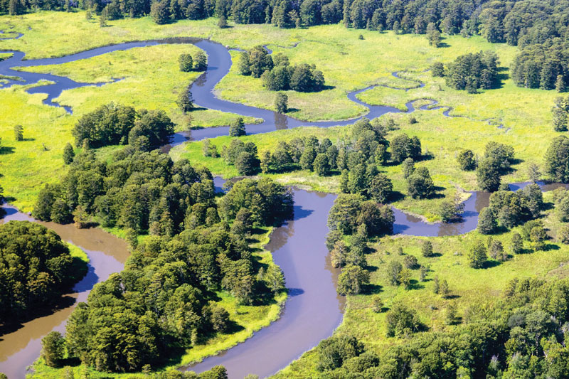
The Eastern Shore
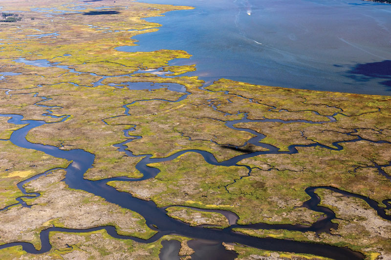
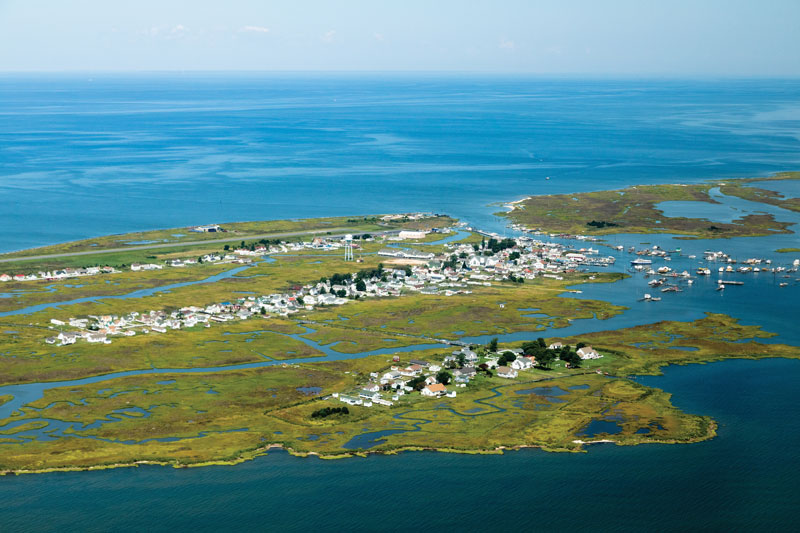
On the first voyage, a ship outbound from Jamestown to England took the Discovery Barge in tow to the Virginia Capes, from which Smith briefly explored the lower seaside of Virginia’s Eastern Shore and then traveled up the bayside of the same, mapping harbors and visiting the Chief of the Accomac. The crew endured a summer thunderstorm around Tangier Island and then went up the Pocomoke River in search of fresh water, reaching the site of today’s Pocomoke City.
Returning to Tangier Sound through Cedar Straits, where the Virginia-Maryland state line lies today, Smith and crew explored the east side of the Sound until another thunderstorm blew out their sails and broke their mast. They spent a nasty, hot, and buggy few days on Bloodsworth Island repairing their boat’s rig and then headed up the Nanticoke and visited that river’s people. There Smith learned of a powerful tribe to the north called the Susquehannock who lived on a great waterway. Sensing the possibility of a Northwest Passage, Smith immediately headed west, through Hooper Strait and across the Bay to the Western Shore around Calvert Cliffs before heading north. Except for some time spent with the Tockwogh people on today’s Sassafras River later that summer, he never returned to the Eastern Shore.
Today, there is much for modern explorers to see, especially on the Pocomoke and Nanticoke Rivers, which have been important to the maritime history of the Chesapeake ever since, and the island chain that runs from Watts and Tangier in the south to Bloodsworth in the north. Some parts of both the islands and the two rivers look very much the same as they did in Smith’s time.
The Upper Bay
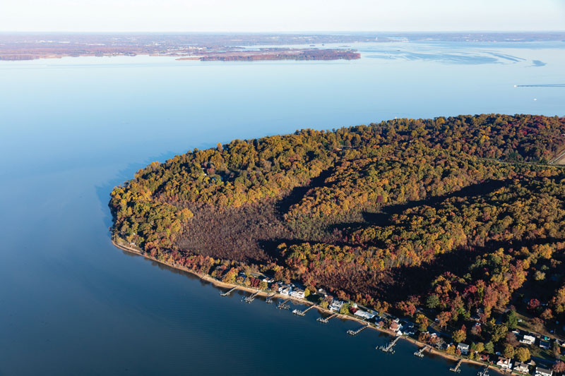
On this first voyage up the Bay, Smith followed the Western Shore until he found a tributary he thought large enough for the ships of the day. He turned the Discovery Barge west and followed it to its head of navigation. That location would be today’s Elkridge, MD, and the river he named Bolus Flu would become the Patapsco. He mapped it carefully and even went up to the mouth of the next river, which would become the Gunpowder, but the crew ran out of stores and grew increasingly dispirited. A stirring speech from their captain inspired them, but the weather shut them in for several days. Smith reluctantly turned south. By the time they reached the mouth of the Potomac, however, they had regained their spirits enough to spend three weeks up that river before heading back to Jamestown to restock supplies.
On the second voyage, Smith made straight for the head of the Bay, finding that it divided four ways (from west to east, today’s Susquehanna, Northeast, Elk, and Sassafras Rivers). Here captain and crew encountered several canoes of powerful Massawomeck warriors off the mouth of the Sassafras, where they had just done battle with the Tockwogh. Although cautious, the Massawomeck traded food, furs, and weapons with the English. Later they disappeared, while Smith steered up the Sassafras.
The Tockwogh, seeing Massawomeck weapons, concluded that the English had fought with and beaten their enemies, and the wily Smith did not disabuse them of that notion. The Tockwogh welcomed the crew and told Smith about a great people they called the Susquehannock who lived up the great river that now bears a variant of that name. They helped Smith arrange a parley with the upriver tribe, probably on today’s Garrett Island, just inside the river’s mouth. Having met these tribes, mapped the head of the Bay, and discovered that it did not lead to a Northwest Passage, Smith turned south, headed back to Jamestown. On the way down, he and his crew explored the Patuxent, mapping it as far up as today’s Lyons Creek, just below Jug Bay.
If Smith were to visit today, he would be stunned by changes to the Patapsco, but he might recognize Garrett Island. The head of the Bay has become a playground for people from Wilmington, Baltimore, and Philadelphia, but there are still interesting sections of these waters for the enterprising explorer. Likewise, the upper tidal Patuxent is remarkably well preserved, despite its proximity to Washington, DC.
The Western Shore
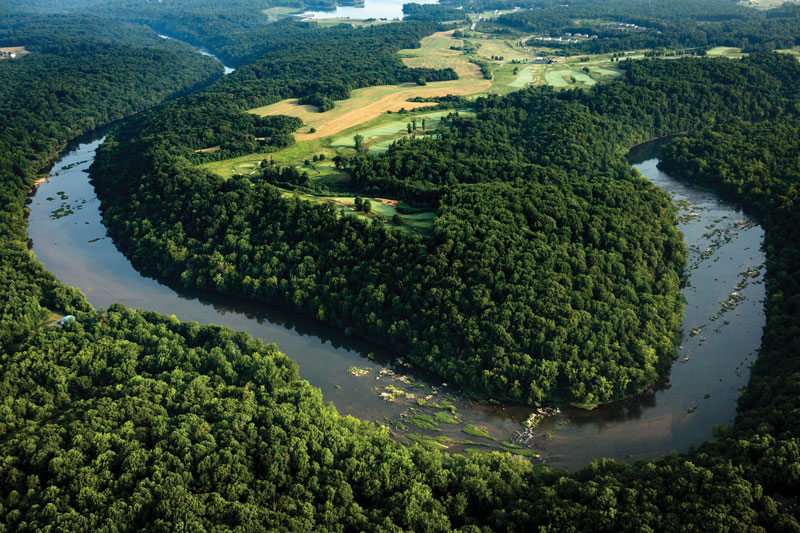
On the first voyage of 1608, Smith and his crew ascended the Potomac all the way to today’s Little Falls and walked to Great Falls. In the process, they converted an ambush at today’s Nomini Creek into a friendly visit, explored a rumored silver mine in the headwaters of Aquia Creek with members of the Patawomeck Tribe, and visited over a dozen American Indian towns on each side, taking notes for the map as they went.
On the first voyage, they started to explore the Rappahannock after visiting the Potomac, but Smith suffered his famous encounter with a stingray and found it prudent to head for home. On the second voyage, they traveled all the way to the falls at today’s Fredericksburg, surviving three ambushes by members of the Rappahannock and Mannahoac tribes. They were assisted by wise counsel and supplies from the friendly Moraughtacund people at the site of today’s Morattico, on Lancaster Creek.
After the Rappahannock, Smith and his crew explored the Piankatank and Elizabeth Rivers but found few people. Just before returning to Jamestown early in September, they survived an ambush by Nansemond warriors in their river, winning a victory that bought them corn to take back to the colony.
Smith did not go up either the James or the York Rivers on the two summer voyages. He didn’t need to, because he spent a good deal of his time in Virginia traveling up and down them at all seasons, meeting the people along them, trading for corn, and negotiating with Powhatan, the paramount chief of the region. His journals record much that happened on these trips.
Today, these rivers lend themselves well to water trail explorers. While the Potomac obviously looks quite different around Washington, DC, Smith would still recognize many of its tributaries, such as Nomini and Nanjemoy creeks. Though clouded by sediment runoff, the Rappahannock retains stunning natural views, especially between Tappahannock and Fredericksburg. The Pamunkey and Mattaponi Rivers, headwaters of the York, remain largely wild, as does the Chickahominy, a large tributary that enters the James just west of Jamestown. Finally, the James offers much to explore, from wild creeks like Powell’s to the historical exhibits at Henricus Historical Park, upriver near Richmond.
For more information, visit nps.gov/cajo. If you missed Part One, you can catch up on our See the Bay page. And stay tuned for Part Three in our April issue!
By John Page Williams