In early August, 1608, Captain John Smith and his crew “fell with the River Pawtuxunt.” Smith hardly mentions this part of his trip, only that the Pawtuxunt Chief treated him and his crew kindly. It’s easy to see where he went, though, from his map. It shows a dozen Native American towns and uncanny detail of the Patuxent’s meanders up to today’s Lyons Creek, the boundary between Calvert and Anne Arundel Counties on the east side of the river, and Mattaponi Creek on the west (Prince George’s) side just upstream. Above there, the map degenerates into perfunctory scribble.
Exploring the Patuxent River Today
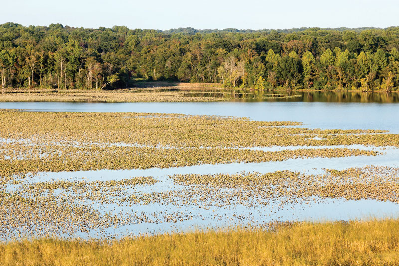
The uppermost villages on Smith’s map are Mattapanient, on the west side, and Quactataugh opposite, at the mouth of Lyons Creek. Mattapanient today is the Merkle Wildlife Sanctuary of the Maryland Department of Natural Resources. Upstream is Jug Bay—broad, shallow water whose wooded shores are protected by the Patuxent River Park on the west and the Jug Bay Wetland Sanctuary on the east.
This part of the Patuxent is still tidal, but far enough upstream to be fresh water. Thanks to good public access, it still offers excellent “John Smith Views” of water, marsh, and forest. It’s hard to believe this jewel of protected woodland and marsh is only 25 miles from Capitol Hill.
Trip Itineraries:
Canoes, Kayaks, and Paddleboards on Mattaponi Creek (Easy two-way trip, 3.5 miles)
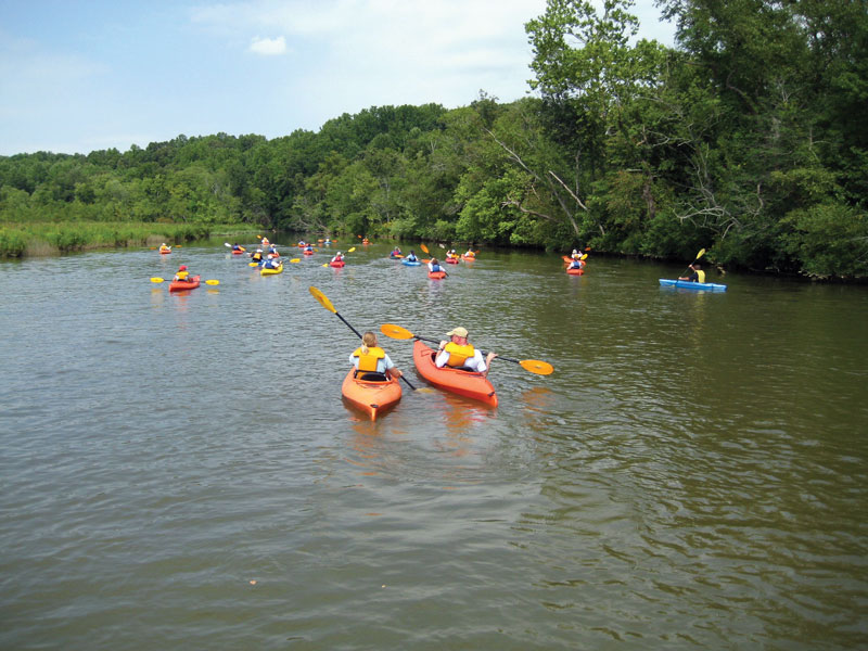
Launch at the Patuxent River Park’s Selby’s Landing, at the lower end of Jug Bay. Paddle downriver a quarter-mile and turn right into Mattaponi Creek.
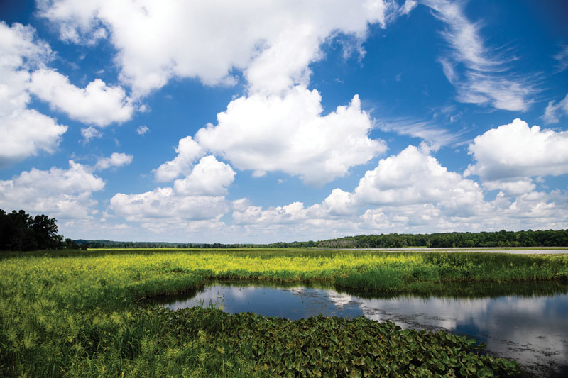
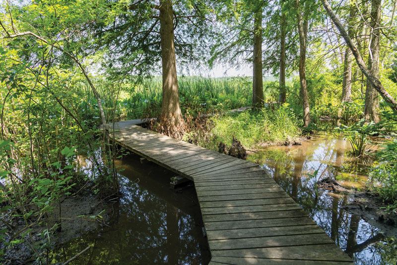
This meandering waterway looks right out of Capt. John Smith’s time. Thanks to the park, which owns the north bank, and the Merkle Sanctuary, which owns the south, the creek’s watershed is still mostly wooded. Paddling upstream, you’ll find the first mile marshy on both sides. These are rich, diverse tidal fresh marshes. The high land on the Merkle side was the site of Mattapanient Town, which Capt. Smith and his crew visited. If you study Google Earth, you’ll notice that it looks out over a very large marsh on the inside of the river’s curve opposite Lyons Creek, with commanding views both up- and down-river and landings on both its upstream and downstream edges. Back on the creek, you’ll soon come to tiny White Oak Landing, now part of the sanctuary but probably in use by humans since before the time of Smith’s visit in 1608. All that’s there today is an abandoned cinderblock shed, but it’s a good place to stop and stretch your legs.
From White Oak Landing up, Mattaponi Creek winds back and forth between marsh and woods, gradually getting shallower, with increasingly large beds of underwater grasses. You may not like the way they slow down your boat, but thank them for the habitat and food they provide for fish and birds. You’ll pass under the wooden bridge for the Critical Areas Driving Tour, but otherwise the creek will look much as it must have when the people of Mattapanient hunted, fished, and foraged it.
On the return to the creek’s mouth, if the weather is fit and you have enough energy and skill, consider paddling downstream a half-mile, around the first curve (opposite Lyons Creek) and exploring one of the marsh guts that extend into the Merkle/Mattapanient marsh. Bankside stands of seven-foot-tall, big cordgrass will make it feel like paddling up a tunnel. In the fall, you may surprise flocks of mallard and black ducks that feed there (and they’ll surprise you, as they explode off the water right in front of your boat!).

Skiffin’ Down to Nottingham, and Back (Easy two-way trip, about 12 miles)
If you’re running a 14-20-foot skiff or runabout equipped with a pushpole, speed is useful for getting a broader view of the river. Launch at Selby’s. Traveling around 15 knots, you can make it downriver to the 17th century colonial tobacco port of Nottingham and back, with time out for a picnic. Going downriver, you’ll skirt the whole of the Merkle/Mattapanient marsh, go through Deep Turn (the lower landing for Mattapanient), and run down the reach to the curve at Nottingham. If you’ve equipped your boat with a depth sounder, notice the depths at the landings, several of which are over 40 feet. You’ll also notice swirling eddies on the surface in those spots if the current is running.
Capt. Smith mapped the Native town of Wasameus at the site of Nottingham when he visited, but by the mid-17th century, the location had become an important colonial tobacco port. Mariners taking leave back to England were still navigating the Patuxent with Capt. Smith’s map. The town remained a tobacco port into the 19th century. It figured in the Patuxent Campaign of the War of 1812. After the Civil War, it became a landing for steamboats connecting communities along the Patuxent with Baltimore. As you sit in your skiff, try to imagine what this place looked like in Smith’s time and through all of the succeeding 400 years. Today Nottingham holds the headquarters of the Patuxent Riverkeeper Program, a strong voice for conservation of this valuable river corridor.