The Captain John Smith Chesapeake National Historic Trail follows the route undertaken by members of the Jamestown colony throughout the Chesapeake Bay in 1608. In the final part of this three-part series, the author encourages us to see the trail from a new perspective.
Imagine you’re Captain John Smith. You and 12 crew members are outward bound onto broad open water with no map, much less a navigational chart, and no idea what weather you might face. You have food and other provisions for only a few days. You don’t know how long you will be away from Jamestown, or how distant a voyage you face. You don’t know whom you will meet, or how they will receive you. Your first assignment is to explore and map the waterway, but you also want to document the Native people of the region, as well as the flora and fauna of the water and the lands around it, including any natural resources that might become valuable commodities to the Virginia colony.
Fortunately, as a 21st-century explorer, you won’t have to worry about meeting hostile human foes. You’ll have the considerable benefit of good weather forecasts, including even a radar app on your smartphone, and you know where your food is coming from. You’ll have the benefit of charts, probably a chartplotter with depth sounder, maybe a mounted radar system.
Even so, to truly explore Capt. Smith’s Chesapeake Trail, you’ll have to be your own interpreter. Remember that this trail’s “infrastructure” consists of maps, books, websites, and data-gathering buoys. With notable exceptions like the institutions around Jamestown, there are no physical “theme parks” dedicated to Captain John Smith and his explorations. You’ll have to explore, look, and interpret just as he and his crew did. It’s no accident that Capt. Smith often used the word discover as a synonym for explore.
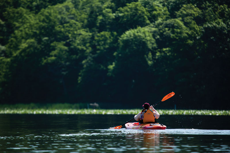
The very nature of a trail makes the journey—the discovery process—more important than any destinations along it. You’re on alert, looking and listening, trying to observe the details of your surroundings, even if you don’t understand how they fit into that part of the Bayscape. What color is the water? How clear or cloudy is it? Do you see evidence of fish or other water creatures? Take advantage of your modern resources to learn everything you can about the water under your hull, the waterway’s bottom beneath it, the air above it, the land around it, and the critters that inhabit it. Modern chartplotter software (even in a phone app) gives a three-dimensional sense of the water and the basin it covers. A short lesson in sonar images can yield an immediate sense of what’s below, from fish and bottom composition (sand, mud, or shell?) to fallen trees, wrecks, oyster reefs, or underwater grass beds. Be sure to take in the aesthetics too, from sunlight glinting on whitecaps (“sheep in the pasture”) to vivid colors (“I’ve seen sunsets that could take the crick out of a man’s back”).
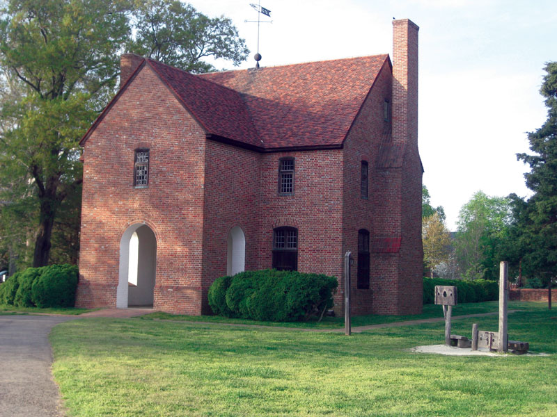
That said, we’re fortunate to have some useful signs, exhibits, and other guideposts around the Chesapeake and its rivers to supplement our own observations. Start with Jamestown itself. Other recreated towns like Henricus Historical Park on the James and Historic St. Mary’s City on the Potomac, along with maritime museums like the Mariners’ Museum and Park in Newport News, the Yorktown Watermen’s Museum, Deltaville Maritime Museum, the Steamboat Era Museum in Irvington, the Reedville Fisherman’s Museum, Calvert Marine Museum in Solomons, the Annapolis Maritime Museum, and the Chesapeake Bay Maritime Museum in St. Michaels help to fill in colonial history. An important element in trail infrastructure in coming years will be the National Park Service’s Chesapeake Bay Gateways Network, “a network of partners and places that provide visitors with opportunities to enjoy, learn about, and help protect the Chesapeake Bay watershed.”
The phrase ‘Exploring the Chesapeake’ tends to bring broad, open waters to mind, but a close look at a map of Capt. Smith’s 1800-mile-long trail brings a reminder that this ecosystem is a network of rivers. Capt. Smith and his crews explored and mapped most of them to their heads of navigation (remember that he was looking for the mythical Northwest Passage through Virginia to The Orient). The riverine nature of this estuary stopped him, of course, but it had already served as a unifying highway for Native tribes for centuries, and it began doing so for the Virginia and Maryland colonists almost immediately after Capt. Smith published his map in 1612.
The Chesapeake’s rivers played critical roles in the development of the colonies, the fledgling United States, the Industrial Revolution of the 19th century, and the busy 20th. They continue to do so today. Capt. Smith’s Chesapeake Trail gives us a clear look at a point in time that offers us views of both what came before his time here (April, 1607 to October, 1609) and everything that has happened since.
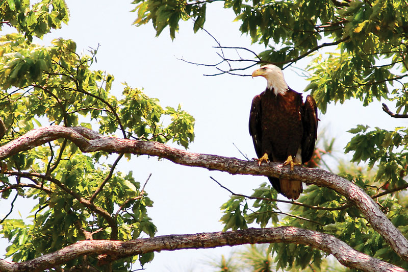
Adjust your thinking and you’ll find that the tidal sections of these rivers are magic. Start with birds. Bald eagles, in fact. The upper sections of the rivers offer abundant fish that eagles seem to love, like gizzard shad and yearling blue catfish. Steep, wooded banks, generally on the outsides of the rivers’ sweeping meander curves, offer them perches from which to survey the water for prey. Where these areas are sufficiently isolated from human activity, the big birds build prodigious nests to incubate, hatch, and rear their young. The same areas also serve as wintering roosts for young eagles from all over the Atlantic coast. In season (March to September), ospreys nest and fish along the same rivers, while great blue herons stalk the shallows.
On the insides of those big meander curves, the currents slow down, allowing suspended sediment to settle out and grow “tidal fresh” marshes. That term sounds like an oxymoron, but our big rivers push a lot of fresh water downstream even after they reach sea level and become affected by the tides pressing in from the Chesapeake. Unlike salt marshes, whose mix of plant species is limited to those few that can deal with salinity, the tidal fresh areas grow a wide range of species, especially seed-bearing annuals like rice cutgrass, smartweed, and wild rice that offer high-energy foods to the ducks, geese, and swans that winter on the Chesapeake.
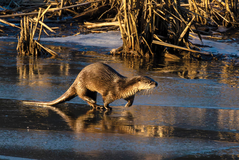
The marshes also provide habitat and food for furbearers like muskrats and river otters, and as the plants break down in winter, their scraps form a springtime soup that feeds the base of the river’s food web. That web sustains tiny crustaceans like copepods, forage fish like shiners and killifish, and an array of larger spawners: yellow (ring) perch, white (gray, stiffback) perch, largemouth bass, blue catfish, rockfish (striped bass), and, amazingly, Atlantic sturgeon. Other spawners that do not feed but still need the rivers’ currents to nurture their eggs include river herring (alewives and bluebacks), hickory shad, and American shad. No wonder the Chesapeake’s Native Tribes learned to live well for centuries on these waterways that still bear their names and their communities today.
The rivers also served them well as highways for hundreds of years. That’s where natural and human history blend on the Chesapeake. The English colonists found that the Chesapeake’s remarkable wealth of navigable waterways provided instant infrastructure in a land without roads. There followed four centuries and more of maritime history, first with tobacco and timber, then sand and gravel, and more recently corn, soybeans, and other grains. Skippers performed amazing feats of seamanship, sailing working schooners and piloting steamboats up the Chesapeake’s rivers to stitch our waterfront communities together. Major battles in the Civil War took place along them. About a century ago, railroads and roadways began to take over commercial traffic, but even today, tugs push barges of grain and building materials along our rivers. Ships still call at Richmond’s Marine Terminal, and our rivers sustain a wide variety of seafood harvesting. Our rivers and we are wound together in a rich ecological and economic fabric worth exploring/discovering. The Captain John Smith Chesapeake National Historic Trail provides you with a framework to begin your own on-the-water voyages following his wake.
By John Page Williams