The Maryland Department of Natural Resources (DNR) has released the Maryland Coastal Flood Explorer, a user-friendly and interactive mapper that allows users to visualize predicted high tide flooding, sea-level rise projections, and historic flooding events for all of Maryland’s coastal areas.
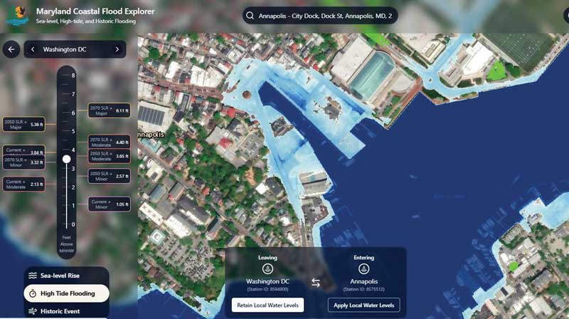
Any resident can go to the Flood Explorer, enter an address, and explore various flood risk scenarios around their property as well as within their broader community.
“Knowledge is our greatest defense, and the Flood Explorer puts the latest coastal flood science directly into the hands of the public,” said Dr. Natalie Snider, director of DNR’s Watershed and Climate Services. “Understanding our flood risk is the first step to building resilience, whether it’s securing your own home with flood insurance or a living shoreline, or as a community through nature-based solutions and resilience projects.”
Communities and residents can explore varying scenarios including current and future high-tide flooding, current and future flood events, projections for sea-level rise by decade through 2120, and historic flood events such as Superstorm Sandy and Hurricane Isabel.
In 2021, DNR’s Watershed and Climate Services led the development of this tool for the Maryland Coastal Zone, giving Maryland communities equal access to high quality and high-resolution flood visualizations. The tool was created with support from the National Oceanic and Atmospheric Administration (NOAA) through the Maryland Coastal Zone Management Program and in collaboration with Salisbury University’s Eastern Shore GIS Cooperative (ESRGC), University of Maryland Sea Grant, and University of Maryland Sea Grant Extension. This tool was made possible by a NOAA grant to the Maryland Coastal Zone Management program.
The tool is the first to display our Maryland-specific sea level rise projections prepared by the University of Maryland Center for Environmental Science and provides communities with a common resource when preparing grant applications, developing Hazard Mitigation and Nuisance Flood Plans, and assessing vulnerable areas for restoration and resilience projects.
The Maryland Coastal Flood Explorer presents flood depths created from locally collected elevation data and Maryland sea-level rise projections. The tool was designed based on feedback from stakeholders and end-users collected throughout the development process.
To view the Maryland Coastal Flood Explorer, visit mdfloodexplorer.org.