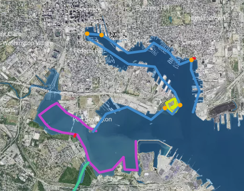
The Chesapeake Conservancy's goal is to eventually map the entire John Smith Chesapeake Trail, and so far, they have mapped nine sections of it.
- Nanticoke River
- Susquehanna-West Branch
- Susquehanna River
- James River
- Mallows Bay-Potomac River
- Rappahannock River
- Fones Cliffs
- Patapsco River
- Baltimore Inner Harbor
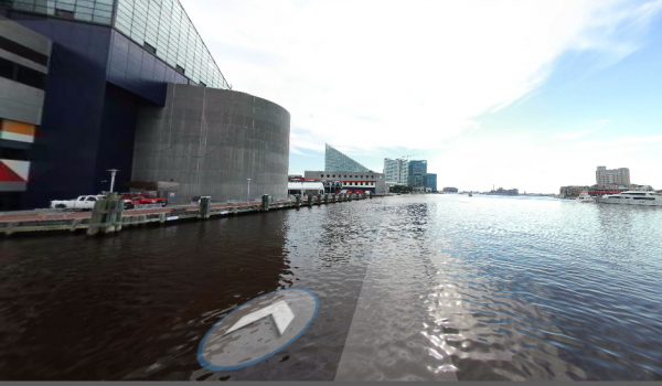
According to the Chesapeake Conservancy website, "Richmond-based Terrain360, built and operates a one-of-a-kind handmade boat, equipped with six cameras mounted 10 feet above the water's surface to capture high-resolution, 360-degree images every 50 feet. These images are stitched together to create a digital image map of the entire river."

The latest virtual tour is of Baltimore's Inner Harbor, allowing users to experience a 360 degree tour from their desktop or mobile device. And with this latest project, the Chesapeake Conservancy went a step farther: Apart from being able to view the waterways around Baltimore, users can also tour the inside of Fort McHenry. Access the full tour at
chesapeakeconservancy.org/apps/innerharbor.
[gallery type="square" link="file" ids="16269,16270"]
 The Chesapeake Conservancy's goal is to eventually map the entire John Smith Chesapeake Trail, and so far, they have mapped nine sections of it.
 The latest virtual tour is of Baltimore's Inner Harbor, allowing users to experience a 360 degree tour from their desktop or mobile device. And with this latest project, the Chesapeake Conservancy went a step farther: Apart from being able to view the waterways around Baltimore, users can also tour the inside of Fort McHenry. Access the full tour at chesapeakeconservancy.org/apps/innerharbor.
[gallery type="square" link="file" ids="16269,16270"]