Update: Jan. 22 9 a.m.
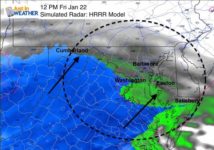
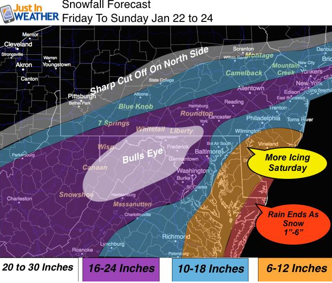
As of this morning, more predictions are out regarding total snow accumulation and when the snow will begin. According to some sources, the snow is likely to start earlier in the day today. From Justin Berk meteorologist:
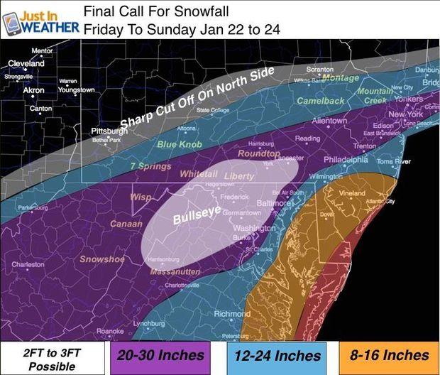
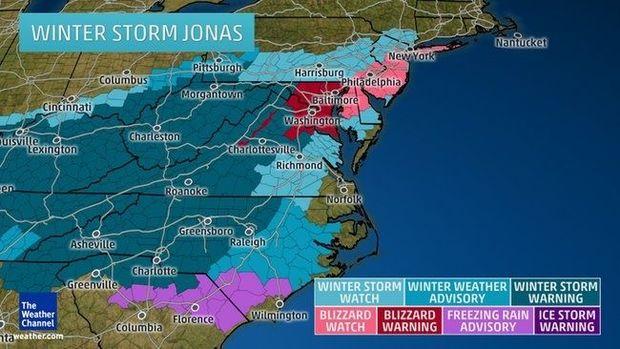
Governor Larry Hogan has declared Maryland under a State of Emergency starting 7 a.m. Friday in anticipation of winter storm Jonas. The national weather service has declared a blizzard warning for much of central Maryland, including the Baltimore and Washington, DC metro areas.
A blizzard by definition, according the National Weather Service, must fulfill certain criteria: winds in excess of 35 mph, with one inch of snow per hour for a three hour period. Heavy snowfall and whiteouts can occur without meeting full blizzard criteria.
According to Governor Hogan, this storm could potentially be the worst storm our state has faced since Snowmageddon in 2010. The snow is predicted to begin Friday evening, between 7 and 10 p.m. in the Baltimore area, and a little earlier in the day near DC, Southern Maryland, and Virginia, according to
meteorologist Justin Berk. Be sure to check your local weather station tomorrow for updates.
A
blizzard warning is in effect until 6 a.m. on Sunday for the following counties: Alleghany, Anne Arundel, Prince George’s, Frederick, Carroll, Baltimore, Charles, St. Mary, Howard, Montgomery, Harford and Calvert counties.
A
blizzard watch is in effect until 6 a.m. Sunday for Queen Anne’s, Talbot, and Caroline counties.
A nor'easter will be moving along the coast near Ocean City, MD, which is likely to cause beach erosion and coastal flooding. The western shore of Maryland could also see some flooding as the high winds could potentially funnel water up the Bay. According to meteorologist Marty Bass, the region will experience tides three to five feet above normal levels, and the full moon will cause the tides to rise another foot. With that in mind,
make sure your boat is secure BEFORE the storm hits. The time to prepare is always before, not during. Here are some tips to keep in mind:
- Make sure dock lines are secure and prepare for the possibility of higher than normal tides and wind gusts up t0 30 knots in some places.
- Ensure tarps/covers are secure and that too much snow/water isn't puddling, especially in the cockpit area. If boats are on a lift, the added weight of snow could potentially push the lift beyond its limits. When the worst of the storm is over, make sure to clear excess snow off of boats, be they on land, lifts, or in the water.
- If your boat is in the water, make sure you have a working deicer or bubbler to prevent ice from forming around the hull.
- Before the storm, make sure your float switch or automatic bilge pump is operating properly.
And remember, as much as we all love our boats, it is not worth venturing out in a blizzard to check on them. Please be safe out there and make sure to make the necessary arrangements before the storm hits. For live updates from WJZ's First warning weather team, click to
baltimore.cbslocal.com. Also click to meteorologist Justin Berk's site,
justinweather.com, for updates.
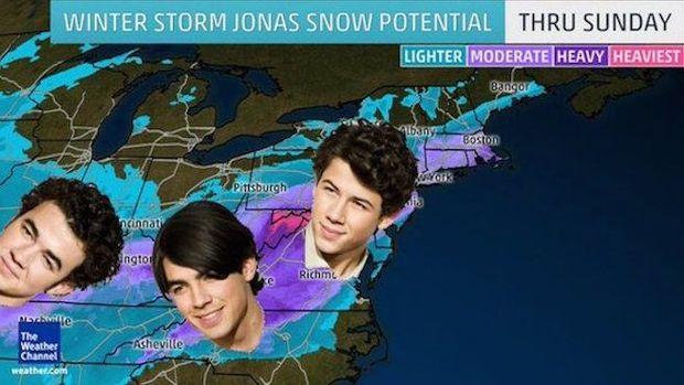
On a lighter note, Twitter is currently abuzz with Jonas Brothers memes due to Winter Storm Jonas. Stay safe, stay warm, and when the snow stops, get out there and enjoy it.


 Governor Larry Hogan has declared Maryland under a State of Emergency starting 7 a.m. Friday in anticipation of winter storm Jonas. The national weather service has declared a blizzard warning for much of central Maryland, including the Baltimore and Washington, DC metro areas.
A blizzard by definition, according the National Weather Service, must fulfill certain criteria: winds in excess of 35 mph, with one inch of snow per hour for a three hour period. Heavy snowfall and whiteouts can occur without meeting full blizzard criteria.
According to Governor Hogan, this storm could potentially be the worst storm our state has faced since Snowmageddon in 2010. The snow is predicted to begin Friday evening, between 7 and 10 p.m. in the Baltimore area, and a little earlier in the day near DC, Southern Maryland, and Virginia, according to meteorologist Justin Berk. Be sure to check your local weather station tomorrow for updates.
 A blizzard warning is in effect until 6 a.m. on Sunday for the following counties: Alleghany, Anne Arundel, Prince George’s, Frederick, Carroll, Baltimore, Charles, St. Mary, Howard, Montgomery, Harford and Calvert counties.
A blizzard watch is in effect until 6 a.m. Sunday for Queen Anne’s, Talbot, and Caroline counties.
 A nor'easter will be moving along the coast near Ocean City, MD, which is likely to cause beach erosion and coastal flooding. The western shore of Maryland could also see some flooding as the high winds could potentially funnel water up the Bay. According to meteorologist Marty Bass, the region will experience tides three to five feet above normal levels, and the full moon will cause the tides to rise another foot. With that in mind, make sure your boat is secure BEFORE the storm hits. The time to prepare is always before, not during. Here are some tips to keep in mind:
