The title says it all, doesn’t it? When navigating out on the water, should you use chartplotters, smart phone/tablet apps, or a combination of the two? It’s a question I find myself fielding a lot as a full-time cruiser and frequent purveyor of boating advice. This is the modern mariner’s conundrum, and the easy answer is “use whatever you are most comfortable with and makes you safest on the water.” At the end of the day, that’s what matters most, but what’s safest is also a bit of a moving target.
There are some diehard old-school paper chart proponents out there wringing their hands over the fact that paper is being left behind by technology. On the other hand, the charts on my chartplotter are as old as the chartplotter itself, and no better than a five-year-old paper chart, because I will never pay the $150 per chart update when I can get always up-to-date charts for a fraction of that with an app subscription on my iPad. On the other hand, my chartplotter isn’t dependent on an internal battery and an external charger and flimsy $5 cord that may or may not always work.
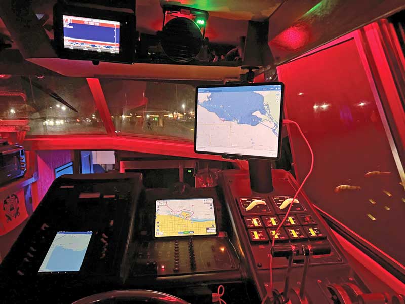
So, for the last decade or two, we all have become very dependent on Multi-Function Devices (MFDs). MFDs from such companies as Raymarine, Garmin, and B&G seem to be literally everywhere on every boat. They’ve proliferated alongside some very worthy competition from phone/tablet apps such as Argo, AquaMap, C-Map, Navionics, Savvy Navvy, and others, and there is huge competition for the hardware vendor just as there is on the software side.
I have a friend who is in the process of boat shopping right now, and he told me that a particular boat he’s looking at has an older hardware suite that he must upgrade if he decides to buy the boat. I asked him what he’s going to use to navigate, and he replied that it would be app-based. So, the next question is, does the currently installed hardware work? It does. The final question then: what does the newer hardware bring to the table that is needed if using apps for charting? The answer is nothing.
If your boat has a working hardware suite that includes sonar/depth, radar, AIS, there is literally nothing else you need that you cannot get from an app. Moreover, if we are honest with ourselves, we have seen this all play out before.
I used to have a TomTom GPS unit in my car to tell me where to go and how to get there. We all had something similar—those familiar GPS units that gave us turn-by-turn driving directions in the decade before smartphones took over our lives. For a few extra bucks you could even have some Hollywood A-lister’s voice do the talking. Most of us have now graduated to a phone on a dashboard mount running Google Maps or Apple Maps. That is the natural progression of things.
I’m going to let you in on a little trade secret that you already know if you even give it half a minute’s thought. A similar transition is almost certainly coming to the boat—you must know it is. Everything is moving onto our phones and tablets.
Yes, we will need sonar sensors, AIS transceivers, and radomes, but once the interfaces to the phone or tablet are worked out, we could see a transition. If you have working equipment, keep it working, and start using apps if you aren’t already.
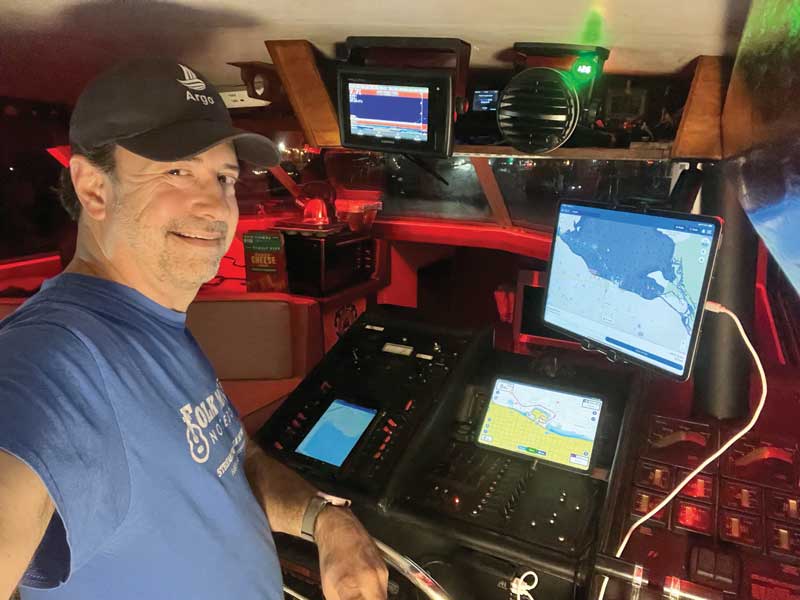
As a matter of full disclosure, I’m a GenXer. I like my tech toys. I like my phone and tablet and all my apps, and my Garmin MFDs, and my NMEA 2000 interface, and all the good things those things can do together. All the same, when I’m on the water, I want options—that’s the time for a belt and suspenders—or, in my case, two belts, and three to five sets of suspenders. If push comes to shove, I can plot a course on my Garmin, but I also have and use three different fully functional navigation apps on my four tablets and two phones (both Apple and Android, thanks). I am an avid user and proponent of Argo, Navionics, and AquaMap. They all have features I like and use, and they all have occasionally failed me at inconvenient times following a bad update or other unforeseen issue.
Just as I’ll never leave the dock without lifejackets or my ditch kit, at least for now, I’ll also never leave the dock without a fully functional MFD and my phone or tablet with multiple app options. When I say multiple apps, just having them on your device isn’t enough; you also need to know how to use them. With that in mind, I took the time to learn how to use my Garmin even though I likely will never use it for navigation unless something happens to my portable devices. I also have taken the time to learn to use every navigation app on my phones and tablets well enough to at least get me home. Tools are only as good as your ability to use them, and it isn’t a backup if you don’t know how to make it work.
So, ultimately, the answer to this question isn’t very nuanced. It comes down to the same advice old salts have been giving for years. Be prepared for everything, and you’ll never have to worry about anything—but remember to keep your eyes on the horizon. There is a whole new world coming. Be ready for it.
About the Author: Dave Rowe is a professional musician, full-time cruiser, and an ambassador for the Argo Navigation App. In 2018, he purchased a 38-foot Bayliner motoryacht he named Stinkpot and began to cruise the Great Loop. You can read more about Dave and his partner Stacey's adventures on their Facebook page, "Our Adventures on Stinkpot," and at aboardstinkpot.com.