The Maryland Transportation Authority (MDTA) has announced that as part of Tier 1 of the ongoing Chesapeake Bay Crossing Study, the federal environmental process is taking to the public four preliminary alternatives, including three preliminary corridors and a no-build alternative.
Data indicates these three preliminary corridor alternatives are the only corridors to sufficiently meet the purpose and need in accordance with the National Environmental Policy Act (NEPA). As part of this process, the MDTA will present the no-build alternative, the preliminary corridor alternatives, and the original full range of alternatives from the study for public review and comment at six open houses in September and October.
“While the No-Build alternative and three preliminary corridor alternatives are being included in the federal environmental process for further study, traffic models indicate that one of the three, building a third crossing within the same corridor as the existing Bay Bridge (Corridor 7), would have the most positive impact on reducing traffic,” said MDTA Executive Director Jim Ports.
The MDTA and Federal Highway Administration (FHWA) are following a tiered NEPA process that provides a systematic approach for advancing potential transportation improvements. The purpose of the Bay Crossing Study is to consider potential alternatives to provide expanded traffic capacity and additional access across the Chesapeake Bay to improve mobility, travel reliability, and safety at the existing Bay Bridge, while considering financial viability and environmental responsibility. The study also looks at modal and operational transportation methods including ferry service, bus rapid transit, rail transit and transportation systems management/travel demand management.
The Bay Crossing Study Tier 1 is retaining the No-Build alternative and these Preliminary Corridor Alternatives Retained for Analysis (CARA):
- Corridor 6: MD 100 to US 301 between Pasadena (Anne Arundel County), Rock Hall (Kent County) and Centreville (Queen Anne’s County);
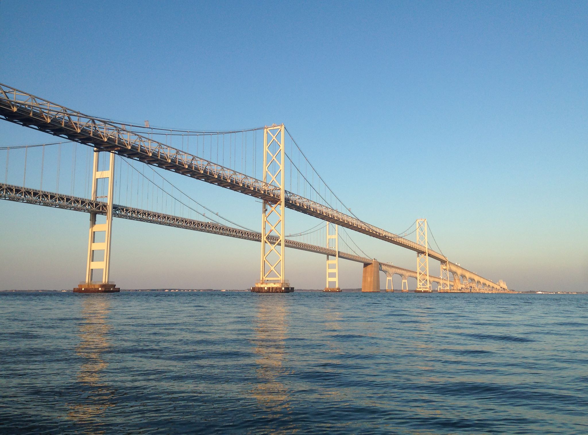
- Corridor 7: existing Bay Bridge corridor, US 50/301 to US 50 between Crofton (Anne Arundel County) and Queenstown (Queen Anne’s County); and
- Corridor 8: US 50/301 between Crofton (Anne Arundel County) and Easton (Talbot County).
Data indicates that each of the three corridor alternatives could have a positive impact on traffic. Corridor 7, the corridor where the existing Bay Bridge is today, provides the most congestion relief. This corridor best relieves congestion at the existing Bay Bridge on both non-summer weekdays and summer weekends compared to all other corridors. Corridor 7 would best reduce backups at the existing Bay Bridge, provide the greatest reduction in the duration of unacceptable congestion levels, and is more compatible with existing land-use patterns, according to the study data.
The regional analyses undertaken during the Tier 1 study involves the evaluation of approximately two-mile wide corridors using a broad-scale level of detail for engineering and environmental information. The Tier 1 study will result in selection of a corridor alternative that best meets the study purpose and need. Following the Tier 1 study, a Tier 2 study would identify specific alignment alternatives within the corridor alternative that is identified in Tier 1.
At the open houses, the MDTA will provide information and receive feedback on the range of alternatives and the Preliminary CARA. Attendees also will learn about the purpose and need aspect of the study, traffic, engineering and environmental considerations, comments received to date, next steps and how to stay informed. For more information on the four preliminary alternatives, visit baycrossingstudy.com to review the public open house display boards. Visit mdta.maryland.gov for information on the upcoming open houses.