I have known boaters who have never dropped their anchor. They go from dock to dock and never know the freedom or the peace that comes from finding that perfect anchorage to relax on a boat, far from the cares and distractions of our modern world. I’ve been a full-time cruiser now for several years, and when we are on the move, nearly every night is an opportunity to know that peace. By the end of this article, hopefully, you will know how to find it too.
Setting the Anchor: Some Assumptions
Rather than covering how to set an anchor—along with vessel-specific considerations like anchor and ground tackle selection—I’ll direct you to the excellent work of writers who have gone deep into these topics. “Anchoring: A Ground Tackler’s Apprentice—Basics and Beyond” by my friends and fellow cruisers, Rudy and Jill Sechez, is an excellent starting point for getting both your boat and crew ready for the anchorage.
In this article, I’ll be mostly focusing on the previous step: selecting the ideal anchorage, with an emphasis on safely spending the night.
The Myth of “Official” Anchorages
First, let’s debunk a common misconception. When you see those (usually green) anchor symbols on navigation or guide apps/sites like Argo, Active Captain, or Waterway Guide, never assume they represent “official” anchorages of any kind. Nearly all are user-contributed, meaning another boater found that spot suitable and decided to share it. While these user-generated recommendations are often reliable, no qualified authority has reviewed most of them. I’ve occasionally seen these little green icons in dangerous areas—such as turning basins or navigation channels—where anchoring can be illegal or outright dangerous. Approach all such spots with due skepticism and caution and always ensure you’re following local anchoring ordinances and staying clear of marked channels.
Lakes, Bays, and Sounds: Simpler Anchoring
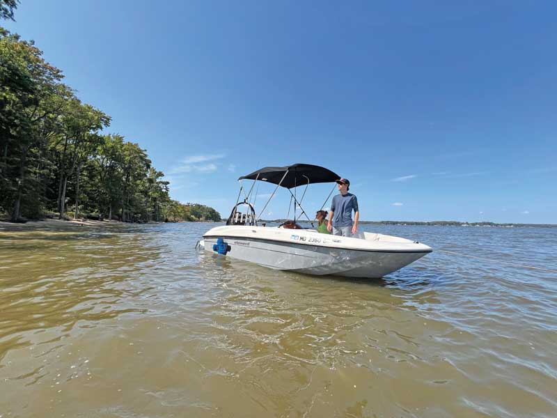
Anchoring in open areas such as lakes, bays, or sounds is relatively straightforward. Look for a spot out of marked channels with plenty of swing room that is sheltered from wind and wave action. Drop your hook and crack a cold beverage.
Rivers, Creeks, and Harbors: Navigating Complexity
In rivers, creeks, or busy harbors, selecting an anchorage becomes more nuanced. Here, you’re much more likely to “be in the way” if you choose poorly.
Last summer, we took the Champlain Canal up to Lake Champlain and returned the same way. On the way back south, we planned to stay at a free bulkhead in Mechanicville, NY. But the locks were a factor. When we asked the Lock 8 keeper if we’d make it to Lock 3, he encouraged us to press on, saying we’d have time.
At Lock 5, we encountered a surprise. The lock keeper asked if we were planning to stay at the Schuylerville Yacht Basin—a nearby marina. We replied that we were on our way to Mechanicville. He then mentioned that Lock 4 had closed for southbound lockages at 2 p.m. to prevent the spread of an invasive fish. We’d just missed the daily cutoff.
When I asked about tying up at the Lock 5 bulkhead, he informed us that overnighting there was no longer allowed because of commercial barge traffic. He also told us, “There are no anchorages between Locks 5 and 4.” Challenge accepted.
Not wanting to pay for a marina night just because a lock keeper didn’t know how to find an anchorage, I scanned the chart and found a mile-long straight section of river (anchoring in a bend can be hazardous) about five miles north of Lock 4, where the channel hugged the west side. With the marked channel well clear of a shallower eastern section, it looked like an ideal spot. When we arrived, we found it to be everything we were hoping it would be and had a very peaceful night there. (Check out this Argo link for the location.)
Anchoring Safely: Lighting and Day Shapes
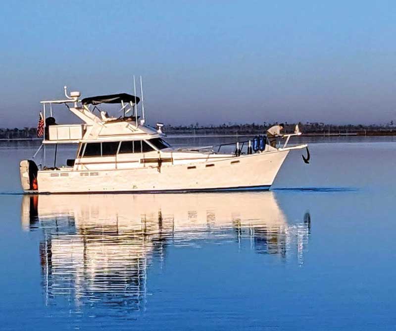
Once you’ve chosen a spot, remember the basics of safe anchoring. Anchor well outside marked channels with enough room to swing with tides, currents, or winds and for other boats to pass freely, including large commercial vessels. Display your anchor light from sundown to sunup. If you’re anchored during daylight hours and your vessel measures more than 23 feet, show a black ball day shape up forward.
You might not be aware that displaying a day shape is required under both the COLREGs and Inland Rules (Rule 30). While rarely enforced on U.S. recreational vessels, having a day shape could protect you in an admiralty court in the event of an allision. If you aren’t displaying an anchor light at night or a day shape in daylight, you could be assigned some or all of the blame if your vessel is struck while at anchor. Fortunately, day shapes are easy to deploy and inexpensive—well worth it for the added peace of mind.
Now, About “Official Anchorages”
There is really only one type of truly official anchorage where you can anchor: federally designated special anchorages. In the U.S., these areas allow vessels to anchor without displaying the black ball day shape or anchor lights (though I still do, anyway). Established by the U.S. Coast Guard, these areas are usually in protected or low-traffic zones. To find them, check government-produced navigation charts or the NOAA ENC view in Argo, which shows these areas clearly outlined with magenta symbology.
Here’s a list of nearby notable special anchorages by region:
Northeast (New York to Maine)
- Manhasset Bay, NY: Western Long Island Sound, ideal for New York Harbor traffic.
- Port Jefferson Harbor, NY: East of NYC on Long Island’s north shore.
- Gloucester Harbor, MA: Near the entrance to Gloucester, north of Boston.
- Boston Inner Harbor, MA: Designated anchorages in Boston Harbor.
- Casco Bay, ME: Anchorages around Portland and Freeport.
Mid-Atlantic (New Jersey to Virginia)
- Harbor of Refuge, Lewes, DE: Near the Delaware Bay entrance.
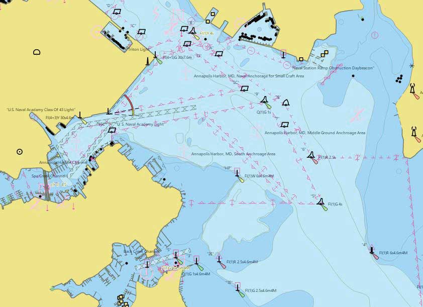
- Chesapeake Bay, MD: Special anchorages in Annapolis Harbor, Galesville, and Severn River.
- Norfolk Harbor, VA: Designated areas for Chesapeake Bay access.
Southeast (North Carolina to Florida)
- Wrightsville Beach, NC: Near the Cape Fear River on the ICW.
- Charleston Harbor, SC: Anchorages near the port of Charleston.
- St. Augustine, FL: Anchoring available in the Matanzas River by historic St. Augustine.
- Fort Pierce, FL: On the Indian River Lagoon along the ICW.
For detailed information, refer to the Code of Federal Regulations (33 CFR Part 110), where each special anchorage is described with coordinates and rules.
About the Author: Dave Rowe is a professional musician, full-time cruiser, and an ambassador for the Argo Navigation App. In 2018, he purchased a 38-foot Bayliner motoryacht he named Stinkpot and began to cruise the Great Loop. You can read more about Dave and his partner Stacey's adventures on their Facebook page, “Our Adventures on Stinkpot,” and at aboardstinkpot.com.