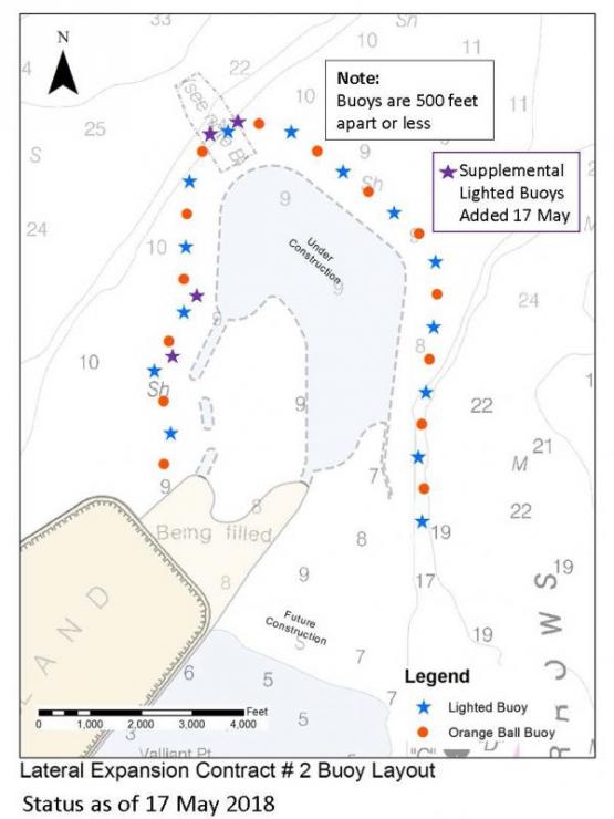
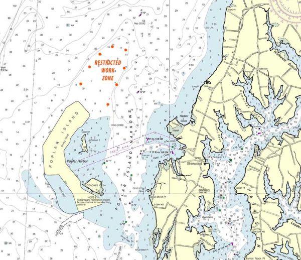
UPDATE: Approximately 32 cautionary buoys have been placed around the Poplar Island work zone, which extends more than a mile north of the existing island. More than half of these buoys are lighted. These buoys are intended to steer boaters away from potentially dangerous submerged rocks that are part of the ongoing Poplar Island expansion project.

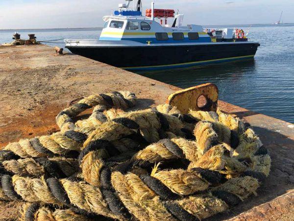
If you're traveling around Poplar Island, you'll want to be aware of this Sécurité, or navigational warning to boaters from Captain Sean Martin on the crewboat Morning Dew.
“Sécurité, sécurité, sécurité All stations, all stations, all stations. This is Crewboat Morning Dew All vessels operating in the vicinity of Poplar Island and the mouth of Eastern Bay. Please be advised of the Restricted Work Zone on the North and East sides of Poplar Island. Construction for the ongoing lateral expansion to the Island is marked with round orange buoys and white cylindrical buoys. The Restricted Work Zone extends 2.4 miles around the NE end of Poplar Island and contains hazards to recreational boating including SUBMERGED UNMARKED ROCK PILES. Crewboat Morning Dew, Out"
As winter releases its grip on the Bay, increased recreational boating traffic is to be expected. This year's exceptionally cold winter seems to have magnified the “spring effect.” The geography of the North end of Poplar Island has changed drastically since last spring; the Island has expanded by hundreds of acres. It will take time for these changes to show up on your GPS chart plotter. If you are blindly following your previous tracks through these waters you could be in for a nasty surprise.

The current construction activity is placing 2000 TONS of stone PER DAY into the waters NE of Poplar Island. Some of it shows above the water, but much of the construction begins underwater and is invisible to the average boater until the second and third layers of stone are placed. There are usually six barges with construction equipment such as excavators and a crane which are visible as well as several tugboats, push boats, survey boats, and our crewboat. There have already been several close calls with recreational vessels “cutting-through” the work zone. Although we have tried to intercept and warn these vessels, it is not always possible. Play it safe and steer clear of this work zone. In addition to the marked work zone to the NE of the Island there is a mooring field on the East side of Poplar Island. Although this is outside the “Restricted Work Zone,” it contains hazards that mariners in the area should be aware of and caution is advised.

There are nine big moorings in this area between Poplar Island and Lowes Wharf. Five steel white mooring balls with 50-foot floating lines attached to them, as well as four steel white mooring cans with 50-foot floating lines. Sometimes these moorings have barges or tugboats on them, but sometimes they may be empty. Again, steer clear of this area and operate with caution. Whenever you are in doubt of a vessels intentions, attempt to contact them on channel 16 VHF. Commercial traffic monitors other channels as well, but you can always make initial contact on 16. For more info on the Poplar Island expansion project, click to the U.S. Army Corps of Engineers page.
By Captain Sean Martin